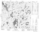
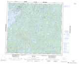
Maps showing William Anderson Lake, 95-20W, Manitoba
William Anderson Lake is a Lake located in 95-20W, Manitoba.
- Latitude: 57° 12' 18'' North (decimal: 57.2049999)
- Longitude: 100° 35' 39'' West (decimal: -100.5941999)
- Topography Feature Category: Lake
- Geographical Feature: Lake
- Canadian Province/Territory: Manitoba
- Location: 95-20W
- Atlas of Canada Locator Map: William Anderson Lake
- GPS Coordinate Locator Map: William Anderson Lake Lat/Long
William Anderson Lake NTS Map Sheets