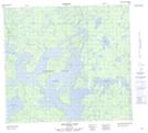
Maps showing Davidson Island, 97-02E, Manitoba
Davidson Island is a Island located in 97-02E, Manitoba and has an elevation of 241 meters.
- Latitude: 57° 23' 29'' North (decimal: 57.3913999)
- Longitude: 97° 17' 51'' West (decimal: -97.2974999)
- Topography Feature Category: Island
- Geographical Feature: Island
- Canadian Province/Territory: Manitoba
- Elevation: 241 meters
- Location: 97-02E
- Atlas of Canada Locator Map: Davidson Island
- GPS Coordinate Locator Map: Davidson Island Lat/Long
Davidson Island NTS Map Sheets