Maps showing Williams Rapids, 78-21E1, Manitoba
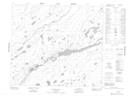
Williams Rapids is a Rapids located in 78-21E1, Manitoba.
- Latitude: 55° 44' 11'' North (decimal: 55.7364000)
- Longitude: 94° 11' 5'' West (decimal: -94.1846999)
- Topography Feature Category: Rapids
- Geographical Feature: Rapids
- Canadian Province/Territory: Manitoba
- Location: 78-21E1
- Atlas of Canada Locator Map: Williams Rapids
- GPS Coordinate Locator Map: Williams Rapids Lat/Long
Williams Rapids NTS Map Sheets