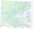
Maps showing Elm Creek, 32-55-29-W1, Manitoba
Elm Creek is a River located in 32-55-29-W1, Manitoba.
- Latitude: 53° 47' 37'' North (decimal: 53.7935999)
- Longitude: 101° 44' 25'' West (decimal: -101.7402999)
- Topography Feature Category: River
- Geographical Feature: Creek
- Canadian Province/Territory: Manitoba
- Location: 32-55-29-W1
- Atlas of Canada Locator Map: Elm Creek
- GPS Coordinate Locator Map: Elm Creek Lat/Long
Elm Creek NTS Map Sheets