Canada Topographic Maps

Rivière Brokenhead Topo Maps

Topography maps and Latitude/Longitude Location

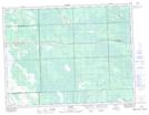
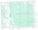
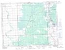
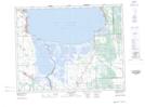
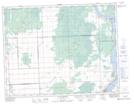
Maps showing Rivière Brokenhead, 26-16-6-E, Manitoba

Rivière Brokenhead is a River located in 26-16-6-E, Manitoba and has an elevation of 227 meters.

  • Latitude: 50° 23' 46'' North   (decimal: 50.3961111)
  • Longitude: 96° 39' 32'' West   (decimal: -96.6588888)
  • Topography Feature Category: River
  • Geographical Feature: Rivière
  • Canadian Province/Territory: Manitoba
  • Elevation: 227 meters
  • Location: 26-16-6-E
  • Atlas of Canada Locator Map: Rivière Brokenhead
  • GPS Coordinate Locator Map: Rivière Brokenhead Lat/Long

Rivière Brokenhead NTS Map Sheets

062H09 Richer Topographic Map at 1:50,000 scale

062H16 Vivian Topographic Map at 1:50,000 scale

062I01 Molson Topographic Map at 1:50,000 scale

062I07 Netley Marsh Topographic Map at 1:50,000 scale

062I08 Lac Du Bonnet Topographic Map at 1:50,000 scale

062H Winnipeg Topographic Map at 1:250,000 scale

062I Selkirk Topographic Map at 1:250,000 scale

 
Buy Topographic Maps DVD
Newsletter Sign-up

Yes, I want to receive map store discounts.


Bookmark and Share