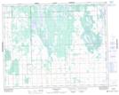
Maps showing Washow Bay Wildlife Management Area, 22-25-3E, Manitoba
Washow Bay Wildlife Management Area is a Conservation area located in 22-25-3E, Manitoba.
- Latitude: 51° 10' 11'' North (decimal: 51.1697000)
- Longitude: 97° 5' 31'' West (decimal: -97.0918999)
- Topography Feature Category: Conservation area
- Geographical Feature: Wildlife Management Area
- Canadian Province/Territory: Manitoba
- Location: 22-25-3E
- Atlas of Canada Locator Map: Washow Bay Wildlife Management Area
- GPS Coordinate Locator Map: Washow Bay Wildlife Management Area Lat/Long