Canada Topographic Maps

St. Andrews Topo Maps

Topography maps and Latitude/Longitude Location

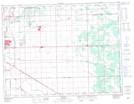
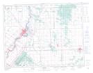
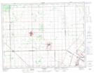
Maps showing St. Andrews, Manitoba

St. Andrews is a Geographical area located in Manitoba.

  • Latitude: 50° 4' 5'' North   (decimal: 50.0681000)
  • Longitude: 96° 58' 30'' West   (decimal: -96.9749999)
  • Topography Feature Category: Geographical area
  • Geographical Feature: Parish
  • Canadian Province/Territory: Manitoba
  • Atlas of Canada Locator Map: St. Andrews
  • GPS Coordinate Locator Map: St. Andrews Lat/Long

St. Andrews NTS Map Sheets

062H15 Dugald Topographic Map at 1:50,000 scale

062I02 Selkirk Topographic Map at 1:50,000 scale

062I03 Stonewall Topographic Map at 1:50,000 scale

062H Winnipeg Topographic Map at 1:250,000 scale

062I Selkirk Topographic Map at 1:250,000 scale

 
Buy Topographic Maps DVD
Newsletter Sign-up

Yes, I want to receive map store discounts.


Bookmark and Share