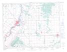
Maps showing St. Clements, Manitoba
St. Clements is a Geographical area located in Manitoba.
- Latitude: 50° 7' 55'' North (decimal: 50.1318999)
- Longitude: 96° 52' 4'' West (decimal: -96.8677999)
- Topography Feature Category: Geographical area
- Geographical Feature: Parish
- Canadian Province/Territory: Manitoba
- Atlas of Canada Locator Map: St. Clements
- GPS Coordinate Locator Map: St. Clements Lat/Long