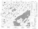
Maps showing McIntosh Island, 69-20E, Manitoba
McIntosh Island is a Island located in 69-20E, Manitoba.
- Latitude: 55° 1' 17'' North (decimal: 55.0213999)
- Longitude: 94° 32' 17'' West (decimal: -94.5381000)
- Topography Feature Category: Island
- Geographical Feature: Island
- Canadian Province/Territory: Manitoba
- Location: 69-20E
- Atlas of Canada Locator Map: McIntosh Island
- GPS Coordinate Locator Map: McIntosh Island Lat/Long
McIntosh Island NTS Map Sheets