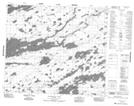
Maps showing Albert Brown Lake, 71-11E, Manitoba
Albert Brown Lake is a Lake located in 71-11E, Manitoba.
- Latitude: 55° 10' 31'' North (decimal: 55.1753000)
- Longitude: 95° 55' 6'' West (decimal: -95.9182999)
- Topography Feature Category: Lake
- Geographical Feature: Lake
- Canadian Province/Territory: Manitoba
- Location: 71-11E
- Atlas of Canada Locator Map: Albert Brown Lake
- GPS Coordinate Locator Map: Albert Brown Lake Lat/Long
Albert Brown Lake NTS Map Sheets