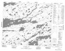
Maps showing Carl Anderson Island, 71-11E, Manitoba
Carl Anderson Island is a Island located in 71-11E, Manitoba.
- Latitude: 55° 8' 37'' North (decimal: 55.1436000)
- Longitude: 95° 49' 37'' West (decimal: -95.8269000)
- Topography Feature Category: Island
- Geographical Feature: Island
- Canadian Province/Territory: Manitoba
- Location: 71-11E
- Atlas of Canada Locator Map: Carl Anderson Island
- GPS Coordinate Locator Map: Carl Anderson Island Lat/Long
Carl Anderson Island NTS Map Sheets