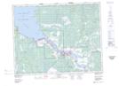
Maps showing Nathan Chevrefils Creek, 10-18-10 E. P. M., Manitoba
Nathan Chevrefils Creek is a River located in 10-18-10 E. P. M., Manitoba.
- Latitude: 50° 31' 29'' North (decimal: 50.5247000)
- Longitude: 96° 8' 21'' West (decimal: -96.1392000)
- Topography Feature Category: River
- Geographical Feature: Creek
- Canadian Province/Territory: Manitoba
- Location: 10-18-10 E. P. M.
- Atlas of Canada Locator Map: Nathan Chevrefils Creek
- GPS Coordinate Locator Map: Nathan Chevrefils Creek Lat/Long