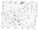
Maps showing Parker Creek, 80-15E, Manitoba
Parker Creek is a River located in 80-15E, Manitoba.
- Latitude: 55° 53' 57'' North (decimal: 55.8991999)
- Longitude: 95° 10' 52'' West (decimal: -95.1811000)
- Topography Feature Category: River
- Geographical Feature: Creek
- Canadian Province/Territory: Manitoba
- Location: 80-15E
- Atlas of Canada Locator Map: Parker Creek
- GPS Coordinate Locator Map: Parker Creek Lat/Long
Parker Creek NTS Map Sheets