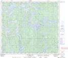
Maps showing Adolf Anderson Lake, 82-11-W, Manitoba
Adolf Anderson Lake is a Lake located in 82-11-W, Manitoba.
- Latitude: 56° 5' 41'' North (decimal: 56.0947000)
- Longitude: 99° 7' 35'' West (decimal: -99.1264000)
- Topography Feature Category: Lake
- Geographical Feature: Lake
- Canadian Province/Territory: Manitoba
- Location: 82-11-W
- GPS Coordinate Locator Map: Adolf Anderson Lake Lat/Long
Adolf Anderson Lake NTS Map Sheets