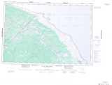
Maps showing Lawrence Johnston Creek, 88-27E2, Manitoba
Lawrence Johnston Creek is a River located in 88-27E2, Manitoba.
- Latitude: 56° 36' 10'' North (decimal: 56.6028000)
- Longitude: 89° 29' 57'' West (decimal: -89.4992000)
- Topography Feature Category: River
- Geographical Feature: Creek
- Canadian Province/Territory: Manitoba
- Location: 88-27E2
- Atlas of Canada Locator Map: Lawrence Johnston Creek
- GPS Coordinate Locator Map: Lawrence Johnston Creek Lat/Long
Lawrence Johnston Creek NTS Map Sheets