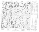
Maps showing Stewart Creek, 95-22W, Manitoba
Stewart Creek is a River located in 95-22W, Manitoba.
- Latitude: 57° 15' 21'' North (decimal: 57.2557999)
- Longitude: 100° 58' 8'' West (decimal: -100.9688999)
- Topography Feature Category: River
- Geographical Feature: Creek
- Canadian Province/Territory: Manitoba
- Location: 95-22W
- Atlas of Canada Locator Map: Stewart Creek
- GPS Coordinate Locator Map: Stewart Creek Lat/Long
Stewart Creek NTS Map Sheets