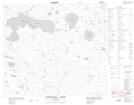
Maps showing Lawrie Bay, 82-7W, Manitoba
Lawrie Bay is a Bay located in 82-7W, Manitoba.
- Latitude: 56° 9' 32'' North (decimal: 56.1588999)
- Longitude: 98° 27' 21'' West (decimal: -98.4558000)
- Topography Feature Category: Bay
- Geographical Feature: Bay
- Canadian Province/Territory: Manitoba
- Location: 82-7W
- Atlas of Canada Locator Map: Lawrie Bay
- GPS Coordinate Locator Map: Lawrie Bay Lat/Long
Lawrie Bay NTS Map Sheets