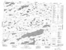
Maps showing John Thompson Lake, 77-10E, Manitoba
John Thompson Lake is a Lake located in 77-10E, Manitoba.
- Latitude: 55° 42' 8'' North (decimal: 55.7021999)
- Longitude: 95° 56' 18'' West (decimal: -95.9382999)
- Topography Feature Category: Lake
- Geographical Feature: Lake
- Canadian Province/Territory: Manitoba
- Location: 77-10E
- Atlas of Canada Locator Map: John Thompson Lake
- GPS Coordinate Locator Map: John Thompson Lake Lat/Long
John Thompson Lake NTS Map Sheets