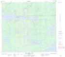
Maps showing Starrett Island, 87-4W, Manitoba
Starrett Island is a Island located in 87-4W, Manitoba.
- Latitude: 56° 31' 32'' North (decimal: 56.5256000)
- Longitude: 98° 1' 24'' West (decimal: -98.0233000)
- Topography Feature Category: Island
- Geographical Feature: Island
- Canadian Province/Territory: Manitoba
- Location: 87-4W
- Atlas of Canada Locator Map: Starrett Island
- GPS Coordinate Locator Map: Starrett Island Lat/Long
Starrett Island NTS Map Sheets