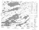
Maps showing Hawkins Island, 72-10E, Manitoba
Hawkins Island is a Island located in 72-10E, Manitoba.
- Latitude: 55° 15' 35'' North (decimal: 55.2596999)
- Longitude: 95° 57' 33'' West (decimal: -95.9591999)
- Topography Feature Category: Island
- Geographical Feature: Island
- Canadian Province/Territory: Manitoba
- Location: 72-10E
- Atlas of Canada Locator Map: Hawkins Island
- GPS Coordinate Locator Map: Hawkins Island Lat/Long
Hawkins Island NTS Map Sheets