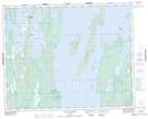
Maps showing Lake St. Andrew, 3 - 32 - 1E, Manitoba
Lake St. Andrew is a Unincorporated area located in 3 - 32 - 1E, Manitoba.
- Latitude: 51° 43' 34'' North (decimal: 51.7261000)
- Longitude: 97° 23' 15'' West (decimal: -97.3874999)
- Topography Feature Category: Unincorporated area
- Geographical Feature: Locality
- Canadian Province/Territory: Manitoba
- Location: 3 - 32 - 1E
- Atlas of Canada Locator Map: Lake St. Andrew
- GPS Coordinate Locator Map: Lake St. Andrew Lat/Long
Lake St. Andrew NTS Map Sheets