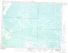
Maps showing Whitemouth Island Ecological Reserve, 3 - 14E, Manitoba
Whitemouth Island Ecological Reserve is a Conservation area located in 3 - 14E, Manitoba.
- Latitude: 49° 15' 44'' North (decimal: 49.2622000)
- Longitude: 95° 41' 19'' West (decimal: -95.6885999)
- Topography Feature Category: Conservation area
- Geographical Feature: Ecological Reserve
- Canadian Province/Territory: Manitoba
- Location: 3 - 14E
- Atlas of Canada Locator Map: Whitemouth Island Ecological Reserve
- GPS Coordinate Locator Map: Whitemouth Island Ecological Reserve Lat/Long
Whitemouth Island Ecological Reserve NTS Map Sheets