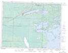
Maps showing Picnic Island, 34 - 8 - 17E, Manitoba
Picnic Island is a Island located in 34 - 8 - 17E, Manitoba.
- Latitude: 49° 42' 26'' North (decimal: 49.7071999)
- Longitude: 95° 11' 41'' West (decimal: -95.1946999)
- Topography Feature Category: Island
- Geographical Feature: Island
- Canadian Province/Territory: Manitoba
- Location: 34 - 8 - 17E
- Atlas of Canada Locator Map: Picnic Island
- GPS Coordinate Locator Map: Picnic Island Lat/Long