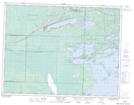
Maps showing Twin Islands, 33 - 8 - 17E, Manitoba
Twin Islands is a Island located in 33 - 8 - 17E, Manitoba.
- Latitude: 49° 42' 27'' North (decimal: 49.7075000)
- Longitude: 95° 12' 56'' West (decimal: -95.2155999)
- Topography Feature Category: Island
- Geographical Feature: Islands
- Canadian Province/Territory: Manitoba
- Location: 33 - 8 - 17E
- Atlas of Canada Locator Map: Twin Islands
- GPS Coordinate Locator Map: Twin Islands Lat/Long