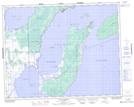
Maps showing Hecla Island Wildlife Refuge, 6 - 24 - 5E, Manitoba
Hecla Island Wildlife Refuge is a Conservation area located in 6 - 24 - 5E, Manitoba.
- Latitude: 51° 3' 54'' North (decimal: 51.0649999)
- Longitude: 96° 45' 56'' West (decimal: -96.7655999)
- Topography Feature Category: Conservation area
- Geographical Feature: Wildlife Refuge
- Canadian Province/Territory: Manitoba
- Location: 6 - 24 - 5E
- Atlas of Canada Locator Map: Hecla Island Wildlife Refuge
- GPS Coordinate Locator Map: Hecla Island Wildlife Refuge Lat/Long