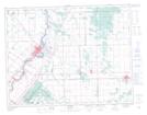
Maps showing Pope John Paul II Hill, 16 - 12 - 5E, Manitoba
Pope John Paul II Hill is a Mountain located in 16 - 12 - 5E, Manitoba.
- Latitude: 50° 0' 58'' North (decimal: 50.0161111)
- Longitude: 96° 51' 28'' West (decimal: -96.8577777)
- Topography Feature Category: Mountain
- Geographical Feature: Hill
- Canadian Province/Territory: Manitoba
- Location: 16 - 12 - 5E
- Atlas of Canada Locator Map: Pope John Paul II Hill
- GPS Coordinate Locator Map: Pope John Paul II Hill Lat/Long