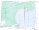
Maps showing Buffalo Point 36, Manitoba
Buffalo Point 36 is a Indian Reserve located in Manitoba.
- Latitude: 49° 0' 59'' North (decimal: 49.0164000)
- Longitude: 95° 15' 42'' West (decimal: -95.2616999)
- Topography Feature Category: Indian Reserve
- Geographical Feature: Indian Reserve - Réserve indienne
- Canadian Province/Territory: Manitoba
- Atlas of Canada Locator Map: Buffalo Point 36
- GPS Coordinate Locator Map: Buffalo Point 36 Lat/Long