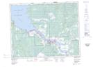
Maps showing Fort Alexander 3, Manitoba
Fort Alexander 3 is a Indian Reserve located in Manitoba.
- Latitude: 50° 36' 23'' North (decimal: 50.6063999)
- Longitude: 96° 17' 38'' West (decimal: -96.2938999)
- Topography Feature Category: Indian Reserve
- Geographical Feature: Indian Reserve - Réserve indienne
- Canadian Province/Territory: Manitoba
- Atlas of Canada Locator Map: Fort Alexander 3
- GPS Coordinate Locator Map: Fort Alexander 3 Lat/Long