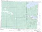
Maps showing Northwest Angle 34C, Manitoba
Northwest Angle 34C is a Indian Reserve located in Manitoba.
- Latitude: 49° 21' 56'' North (decimal: 49.3655999)
- Longitude: 95° 11' 23'' West (decimal: -95.1897000)
- Topography Feature Category: Indian Reserve
- Geographical Feature: Indian Reserve - Réserve indienne
- Canadian Province/Territory: Manitoba
- Atlas of Canada Locator Map: Northwest Angle 34C
- GPS Coordinate Locator Map: Northwest Angle 34C Lat/Long