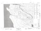
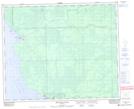
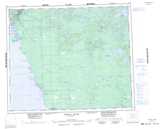
Maps showing Poplar River 16, Manitoba
Poplar River 16 is a Indian Reserve located in Manitoba.
- Latitude: 53° 0' 0'' North (decimal: 53.0000000)
- Longitude: 97° 17' 9'' West (decimal: -97.2857999)
- Topography Feature Category: Indian Reserve
- Geographical Feature: Indian Reserve - Réserve indienne
- Canadian Province/Territory: Manitoba
- Atlas of Canada Locator Map: Poplar River 16
- GPS Coordinate Locator Map: Poplar River 16 Lat/Long
Poplar River 16 NTS Map Sheets