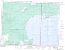
Maps showing Reed River 36A, Manitoba
Reed River 36A is a Indian Reserve located in Manitoba.
- Latitude: 49° 7' 58'' North (decimal: 49.1327999)
- Longitude: 95° 18' 5'' West (decimal: -95.3013999)
- Topography Feature Category: Indian Reserve
- Geographical Feature: Indian Reserve - Réserve indienne
- Canadian Province/Territory: Manitoba
- Atlas of Canada Locator Map: Reed River 36A
- GPS Coordinate Locator Map: Reed River 36A Lat/Long