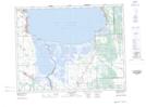
Maps showing Peguis 1E, 17-15-5-EPM, Manitoba
Peguis 1E is a Indian Reserve located in 17-15-5-EPM, Manitoba.
- Latitude: 50° 17' 5'' North (decimal: 50.2846999)
- Longitude: 96° 52' 0'' West (decimal: -96.8666999)
- Topography Feature Category: Indian Reserve
- Geographical Feature: Indian Reserve - Réserve indienne
- Canadian Province/Territory: Manitoba
- Location: 17-15-5-EPM
- Atlas of Canada Locator Map: Peguis 1E
- GPS Coordinate Locator Map: Peguis 1E Lat/Long
Peguis 1E NTS Map Sheets