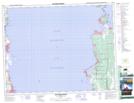
Maps showing Orvis Bay, Manitoba
Orvis Bay is a Bay located in Manitoba.
- Latitude: 50° 32' 11'' North (decimal: 50.53639)
- Longitude: 96° 37' 15'' West (decimal: -96.62083)
- Topography Feature Category: Bay
- Geographical Feature: Bay
- Canadian Province/Territory: Manitoba
- Atlas of Canada Locator Map: Orvis Bay
- GPS Coordinate Locator Map: Orvis Bay Lat/Long
Orvis Bay NTS Map Sheets