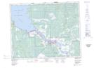
Maps showing Powerview-Pine Falls, Manitoba
Powerview-Pine Falls is a Falls located in Manitoba.
- Latitude: 50° 34' 2'' North (decimal: 50.5672221)
- Longitude: 96° 11' 49'' West (decimal: -96.1969443)
- Topography Feature Category: Falls
- Geographical Feature: Falls
- Canadian Province/Territory: Manitoba
- Atlas of Canada Locator Map: Powerview-Pine Falls
- GPS Coordinate Locator Map: Powerview-Pine Falls Lat/Long