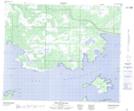
Maps showing Sapotaweyak Cree Nation - Spruce Island, Manitoba
Sapotaweyak Cree Nation - Spruce Island is a Indian Reserve located in Manitoba.
- Latitude: 53° 2' 40'' North (decimal: 53.0444033)
- Longitude: 100° 35' 8'' West (decimal: -100.5855021)
- Topography Feature Category: Indian Reserve
- Geographical Feature: Indian Reserve - Réserve indienne
- Canadian Province/Territory: Manitoba
- Atlas of Canada Locator Map: Sapotaweyak Cree Nation - Spruce Island
- GPS Coordinate Locator Map: Sapotaweyak Cree Nation - Spruce Island Lat/Long
Sapotaweyak Cree Nation - Spruce Island NTS Map Sheets