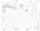
Maps showing Opekunosakakanihk, Manitoba
Opekunosakakanihk is a Indian Reserve located in Manitoba.
- Latitude: 56° 13' 58'' North (decimal: 56.2328678)
- Longitude: 98° 23' 3'' West (decimal: -98.3841971)
- Topography Feature Category: Indian Reserve
- Geographical Feature: Indian Reserve - Réserve indienne
- Canadian Province/Territory: Manitoba
- Atlas of Canada Locator Map: Opekunosakakanihk
- GPS Coordinate Locator Map: Opekunosakakanihk Lat/Long
Opekunosakakanihk NTS Map Sheets