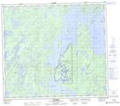
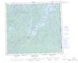
Maps showing Southend Reindeer, Saskatchewan
Southend Reindeer is a Hamlet located in Saskatchewan and has an elevation of 348 meters.
- Latitude: 56° 19' 8'' North (decimal: 56.3189733)
- Longitude: 103° 15' 54'' West (decimal: -103.2649610)
- Topography Feature Category: Hamlet
- Geographical Feature: Northern Hamlet
- Canadian Province/Territory: Saskatchewan
- Elevation: 348 meters
- Atlas of Canada Locator Map: Southend Reindeer
- GPS Coordinate Locator Map: Southend Reindeer Lat/Long
Southend Reindeer NTS Map Sheets