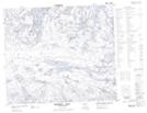
Maps showing Alder Lake, 67-2-W2, Saskatchewan
Alder Lake is a Lake located in 67-2-W2, Saskatchewan and has an elevation of 334 meters.
- Latitude: 54° 48' North (decimal: 54.8000664)
- Longitude: 102° 11' West (decimal: -102.1837345)
- Topography Feature Category: Lake
- Geographical Feature: Lake
- Canadian Province/Territory: Saskatchewan
- Elevation: 334 meters
- Location: 67-2-W2
- Atlas of Canada Locator Map: Alder Lake
- GPS Coordinate Locator Map: Alder Lake Lat/Long
Alder Lake NTS Map Sheets