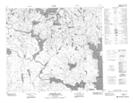
Maps showing Alsmith Lake, 69-12,13-W2, Saskatchewan
Alsmith Lake is a Lake located in 69-12,13-W2, Saskatchewan and has an elevation of 341 meters.
- Latitude: 54° 57' North (decimal: 54.9500691)
- Longitude: 103° 51' West (decimal: -103.8504066)
- Topography Feature Category: Lake
- Geographical Feature: Lake
- Canadian Province/Territory: Saskatchewan
- Elevation: 341 meters
- Location: 69-12,13-W2
- Atlas of Canada Locator Map: Alsmith Lake
- GPS Coordinate Locator Map: Alsmith Lake Lat/Long
Alsmith Lake NTS Map Sheets