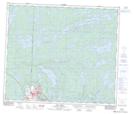
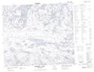
Maps showing Annabel Creek, 67-29-W, Saskatchewan
Annabel Creek is a River located in 67-29-W, Saskatchewan and has an elevation of 337 meters.
- Latitude: 54° 50' 30'' North (decimal: 54.8417376)
- Longitude: 101° 53' 11'' West (decimal: -101.8864998)
- Topography Feature Category: River
- Geographical Feature: Creek
- Canadian Province/Territory: Saskatchewan
- Elevation: 337 meters
- Location: 67-29-W
- Atlas of Canada Locator Map: Annabel Creek
- GPS Coordinate Locator Map: Annabel Creek Lat/Long
Annabel Creek NTS Map Sheets