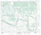
Maps showing Fort Pitt, 11-54-26-W3, Saskatchewan
Fort Pitt is a Unincorporated area located in 11-54-26-W3, Saskatchewan and has an elevation of 580 meters.
- Latitude: 53° 39' North (decimal: 53.6500906)
- Longitude: 109° 45' West (decimal: -109.7507715)
- Topography Feature Category: Unincorporated area
- Geographical Feature: Locality
- Canadian Province/Territory: Saskatchewan
- Elevation: 580 meters
- Location: 11-54-26-W3
- Atlas of Canada Locator Map: Fort Pitt
- GPS Coordinate Locator Map: Fort Pitt Lat/Long
Fort Pitt NTS Map Sheets