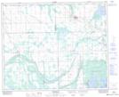
Maps showing Barrier Lake, 41-12,13-W2, Saskatchewan
Barrier Lake is a Lake located in 41-12,13-W2, Saskatchewan and has an elevation of 513 meters.
- Latitude: 52° 32' North (decimal: 52.5333326)
- Longitude: 103° 47' West (decimal: -103.7838227)
- Topography Feature Category: Lake
- Geographical Feature: Lake
- Canadian Province/Territory: Saskatchewan
- Elevation: 513 meters
- Location: 41-12,13-W2
- Atlas of Canada Locator Map: Barrier Lake
- GPS Coordinate Locator Map: Barrier Lake Lat/Long
Barrier Lake NTS Map Sheets