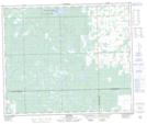
Maps showing Barthel, 3-57-21-W3, Saskatchewan
Barthel is a Unincorporated area located in 3-57-21-W3, Saskatchewan and has an elevation of 582 meters.
- Latitude: 53° 55' North (decimal: 53.9167647)
- Longitude: 109° 3' West (decimal: -109.0507373)
- Topography Feature Category: Unincorporated area
- Geographical Feature: Locality
- Canadian Province/Territory: Saskatchewan
- Elevation: 582 meters
- Location: 3-57-21-W3
- Atlas of Canada Locator Map: Barthel
- GPS Coordinate Locator Map: Barthel Lat/Long