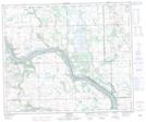
Maps showing Cleeves, 5-52-21-W3, Saskatchewan
Cleeves is a Unincorporated area located in 5-52-21-W3, Saskatchewan and has an elevation of 596 meters.
- Latitude: 53° 28' North (decimal: 53.4667560)
- Longitude: 109° 3' West (decimal: -109.0507232)
- Topography Feature Category: Unincorporated area
- Geographical Feature: Locality
- Canadian Province/Territory: Saskatchewan
- Elevation: 596 meters
- Location: 5-52-21-W3
- Atlas of Canada Locator Map: Cleeves
- GPS Coordinate Locator Map: Cleeves Lat/Long