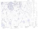
Maps showing Kerr Lake, 64-4,5-W2, Saskatchewan
Kerr Lake is a Lake located in 64-4,5-W2, Saskatchewan and has an elevation of 316 meters.
- Latitude: 54° 32' North (decimal: 54.5333912)
- Longitude: 102° 36' West (decimal: -102.6004263)
- Topography Feature Category: Lake
- Geographical Feature: Lake
- Canadian Province/Territory: Saskatchewan
- Elevation: 316 meters
- Location: 64-4,5-W2
- Atlas of Canada Locator Map: Kerr Lake
- GPS Coordinate Locator Map: Kerr Lake Lat/Long
Kerr Lake NTS Map Sheets