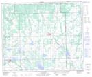
Maps showing Glenbogie, 21-54-23-W3, Saskatchewan
Glenbogie is a Unincorporated area located in 21-54-23-W3, Saskatchewan and has an elevation of 640 meters.
- Latitude: 53° 41' North (decimal: 53.6834270)
- Longitude: 109° 19' West (decimal: -109.3174127)
- Topography Feature Category: Unincorporated area
- Geographical Feature: Locality
- Canadian Province/Territory: Saskatchewan
- Elevation: 640 meters
- Location: 21-54-23-W3
- Atlas of Canada Locator Map: Glenbogie
- GPS Coordinate Locator Map: Glenbogie Lat/Long
Glenbogie NTS Map Sheets