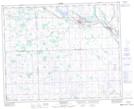
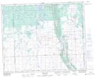
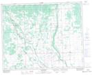
Maps showing Kop Creek, 30-34-4-W2, Saskatchewan
Kop Creek is a River located in 30-34-4-W2, Saskatchewan and has an elevation of 558 meters.
- Latitude: 51° 57' North (decimal: 51.9499906)
- Longitude: 102° 33' West (decimal: -102.5504760)
- Topography Feature Category: River
- Geographical Feature: Creek
- Canadian Province/Territory: Saskatchewan
- Elevation: 558 meters
- Location: 30-34-4-W2
- Atlas of Canada Locator Map: Kop Creek
- GPS Coordinate Locator Map: Kop Creek Lat/Long
Kop Creek NTS Map Sheets