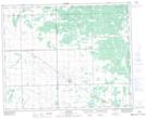
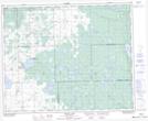
Maps showing High Hill, 20-38-10-W2, Saskatchewan
High Hill is a Unincorporated area located in 20-38-10-W2, Saskatchewan and has an elevation of 628 meters.
- Latitude: 52° 17' North (decimal: 52.2833290)
- Longitude: 103° 23' West (decimal: -103.3838214)
- Topography Feature Category: Unincorporated area
- Geographical Feature: Locality
- Canadian Province/Territory: Saskatchewan
- Elevation: 628 meters
- Location: 20-38-10-W2
- Atlas of Canada Locator Map: High Hill
- GPS Coordinate Locator Map: High Hill Lat/Long
High Hill NTS Map Sheets