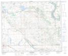
Maps showing Hillmond, 25-51-26-W3, Saskatchewan
Hillmond is a Unincorporated area located in 25-51-26-W3, Saskatchewan and has an elevation of 579 meters.
- Latitude: 53° 26' North (decimal: 53.4334196)
- Longitude: 109° 42' West (decimal: -109.7007670)
- Topography Feature Category: Unincorporated area
- Geographical Feature: Hamlet
- Canadian Province/Territory: Saskatchewan
- Elevation: 579 meters
- Location: 25-51-26-W3
- Atlas of Canada Locator Map: Hillmond
- GPS Coordinate Locator Map: Hillmond Lat/Long
Hillmond NTS Map Sheets