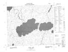
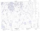
Maps showing Howlett Creek, 63-5-W2, Saskatchewan
Howlett Creek is a River located in 63-5-W2, Saskatchewan.
- Latitude: 54° 25' North (decimal: 54.4167226)
- Longitude: 102° 44' West (decimal: -102.7337668)
- Topography Feature Category: River
- Geographical Feature: Creek
- Canadian Province/Territory: Saskatchewan
- Location: 63-5-W2
- Atlas of Canada Locator Map: Howlett Creek
- GPS Coordinate Locator Map: Howlett Creek Lat/Long
Howlett Creek NTS Map Sheets